
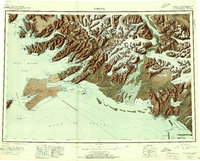
1951 Map of Cordova
USGS Topo · Published 1951About this map
Cordova serves as the focal point of this coastal survey, situated between the glacier-fed waters of Orca Bay and the mountain slopes of the Chugach Range. The geography is defined by a complex network of deep-water inlets, including Port Fidalgo and Port Gravina, which supported early 20th-century industry and transport. A significant historical detail is the route of the Copper River and Northwestern RR (Abandoned), noted here as already out of service, which once linked the interior mineral wealth to the coast near Eyak and Odiak. Smaller settlements like Ellamar and Tatitlek dot the rugged shoreline of the Valdez Arm, while the southeastern corner shows the isolated community of Katalla near Bering Lake. The inclusion of the Cordova Airport and various light stations highlights the region's reliance on maritime and aerial navigation during this post-war era.
Find a feature on this map
225 named features on this map. Tap any name to fly to it.
Don’t see what you’re looking for? This feature index may not catch every label — zoom into the map to look around manually.
Map Details
Editions of this 1951 Cordova Map
3 editions found
Other maps of this area

1946 · Blying Sound
USGS Topo · 1:250,000

1948 · Cordova
USGS Topo · 1:250,000

1948 · Middleton Island
USGS Topo · 1:250,000

1950 · Middleton Island
USGS Topo · 1:250,000

1950 · McCarthy A-8
USGS Topo · 1:63,360

1950 · Bering Glacier
USGS Topo · 1:250,000

1950 · Icy Bay
USGS Topo · 1:250,000

1950 · Valdez A-3
USGS Topo · 1:63,360

1950 · Cordova B-2
USGS Topo · 1:63,360

1950 · Cordova C-7
USGS Topo · 1:63,360