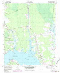
1949 Map of Core Creek
USGS Topo · Published 1984About this map
Adams Creek Canal and the Intracostal Waterway dominate this coastal landscape, serving as a vital maritime corridor through the marshy lowlands of eastern North Carolina. The map documents a sparsely populated region where navigation and timber appear central to the local economy, bounded by the Croatan National Forest and the Croatan Game Land. Small settlements and crossroads communities like Core Creek, Mill Creek, and Live Oak Grove are linked by a network of rural roads such as the New Bern Road and the Turnpike. Along the Newport River, maritime activity is signaled by the presence of Front Range Light and Rear Range Light. The social fabric of the era is preserved through several rural sanctuaries, including Graham Chapel and Harlowe Ch, while Crab Point Village marks a distinct cluster of development at the southern edge of the survey.
Find a feature on this map
45 named features on this map. Tap any name to fly to it.
Don’t see what you’re looking for? This feature index may not catch every label — zoom into the map to look around manually.
Map Details
Editions of this 1949 Core Creek Map
2 editions found
Other maps of this area

1949 · Beaufort
USGS Topo · 1:24,000

1949 · Merrimon
USGS Topo · 1:24,000

1949 · Newport
USGS Topo · 1:24,000

1949 · Williston
USGS Topo · 1:24,000

1949 · Harkers Island
USGS Topo · 1:24,000

1949 · South River
USGS Topo · 1:24,000

1949 · Mansfield
USGS Topo · 1:24,000

1949 · Cherry Point
USGS Topo · 1:24,000

1949 · Core Creek
USGS Topo · 1:24,000

1950 · South River
USGS Topo · 1:24,000