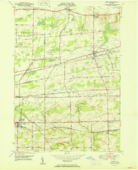
1950 Map of Corfu
USGS Topo · Published 1950About this map
Corfu and the surrounding townships of Pembroke, Newstead, Alden, and Darien sit at a major mid-century transportation nexus along the Erie and Genesee County line. The landscape is defined by a dense network of major railroads, including the New York Central, the Lehigh Valley, the Delaware Lackawanna and Western, and the Erie RR, which converge near settlements like Crittenden and Alden Station. These rails parallel historic thoroughfares such as Broadway and Main Street, which pass through early crossroads like Brick House Corners.
Find a feature on this map
43 named features on this map. Tap any name to fly to it.
Don’t see what you’re looking for? This feature index may not catch every label — zoom into the map to look around manually.
Map Details
Editions of this 1950 Corfu Map
2 editions found
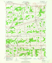
Other maps of this area

1897 · Medina
USGS Topo · 1:62,500

1897 · Lockport
USGS Topo · 1:62,500

1899 · Niagara
USGS Topo · 1:125,000

1902 · Lockport
USGS Topo · 1:62,500

1905 · Attica
USGS Topo · 1:62,500

1905 · Depew
USGS Topo · 1:62,500

1905 · Lockport
USGS Topo · 1:62,500

1944 · Alexander
USGS Topo · 1:31,680

1948 · Depew
USGS Topo · 1:62,500

1948 · Lockport
USGS Topo · 1:62,500