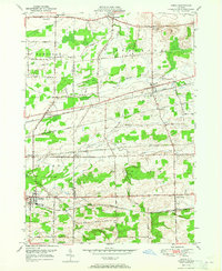
1950 Map of Corfu
USGS Topo · Published 1965About this map
Corfu and the surrounding agricultural landscapes of Genesee and Erie Counties are defined by a complex network of mid-century rail infrastructure. Four major lines, including the New York Central and the Lehigh Valley, slice across the terrain, supporting local stations like Corfu Sta and smaller junctions like Crittenden. The map documents a period when these railroads remained the primary arteries for commerce between small settlements such as Pembroke and Darien Center.
Find a feature on this map
47 named features on this map. Tap any name to fly to it.
Don’t see what you’re looking for? This feature index may not catch every label — zoom into the map to look around manually.
Map Details
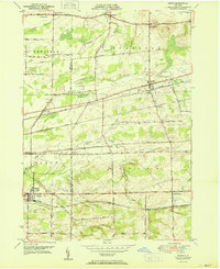
Editions of this 1950 Corfu Map
2 editions found
Other maps of this area

1897 · Medina
USGS Topo · 1:62,500

1897 · Lockport
USGS Topo · 1:62,500

1899 · Niagara
USGS Topo · 1:125,000

1902 · Lockport
USGS Topo · 1:62,500

1905 · Attica
USGS Topo · 1:62,500

1905 · Depew
USGS Topo · 1:62,500

1905 · Lockport
USGS Topo · 1:62,500

1944 · Alexander
USGS Topo · 1:31,680

1948 · Depew
USGS Topo · 1:62,500

1948 · Lockport
USGS Topo · 1:62,500