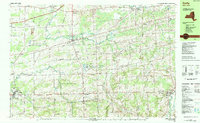
1984 Map of Corfu
USGS Topo · Published 1984About this map
Murder Creek winds through a landscape defined by the intersection of traditional agriculture and mid-century transportation infrastructure. This 1980s-era topographical study highlights the path of the New York State Thruway as it cuts across the northern reaches of Pembroke and Corfu, contrasting with the established Conrail line and the historic Corfu Station. The region's leisure and conservation efforts are evident in the expansive Darien Lakes State Park and the adjacent Darien Lakes Fun Country, indicating the area's transition into a recreational hub for Western New York. Local genealogists will find value in the precise locations of community landmarks such as Hillside Cem, Maple Hill Cem, and Our Lady of Good Counsel Sch, while industrial features like the Quarry and various gas wells speak to the rural economy's reliance on natural resources during this period.
Find a feature on this map
61 named features on this map. Tap any name to fly to it.
Don’t see what you’re looking for? This feature index may not catch every label — zoom into the map to look around manually.
Map Details
Editions of this 1984 Corfu Map
2 editions found
Other maps of this area

1897 · Albion
USGS Topo · 1:62,500

1897 · Medina
USGS Topo · 1:62,500

1897 · Lockport
USGS Topo · 1:62,500

1899 · Niagara
USGS Topo · 1:125,000

1902 · Lockport
USGS Topo · 1:62,500

1904 · Batavia
USGS Topo · 1:62,500

1905 · Attica
USGS Topo · 1:62,500

1905 · Depew
USGS Topo · 1:62,500

1905 · Lockport
USGS Topo · 1:62,500

1944 · Alexander
USGS Topo · 1:31,680