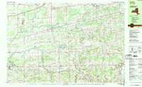
1984 Map of Corfu
USGS Topo · Published 1984About this map
Murder Creek and Tonawanda Creek define the drainage of this Genesee County landscape as it appeared in the mid-1980s. The region is characterized by a mix of agricultural land and early-stage suburban expansion, anchored by settlements like Corfu, Darien Center, and Alexander. The presence of the Conrail line and the New York State Thruway indicates the area's importance as a transportation corridor between major New York hubs. Local recreation and community life are centered around Darien Lakes State Park and Darien Lakes Fun Country, while older local history is preserved at sites like Hillside Cem, Evergreen Cem, and the North Darien Ch. This survey provides a clear view of the transition from rural farming communities to more structured residential and recreational zones, including institutions like Pembroke Jr-Sr High Sch.
Find a feature on this map
62 named features on this map. Tap any name to fly to it.
Don’t see what you’re looking for? This feature index may not catch every label — zoom into the map to look around manually.
Map Details
Editions of this 1984 Corfu Map
2 editions found
Other maps of this area

1897 · Albion
USGS Topo · 1:62,500

1897 · Medina
USGS Topo · 1:62,500

1897 · Lockport
USGS Topo · 1:62,500

1899 · Niagara
USGS Topo · 1:125,000

1902 · Lockport
USGS Topo · 1:62,500

1904 · Batavia
USGS Topo · 1:62,500

1905 · Attica
USGS Topo · 1:62,500

1905 · Depew
USGS Topo · 1:62,500

1905 · Lockport
USGS Topo · 1:62,500

1944 · Alexander
USGS Topo · 1:31,680