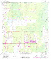
1958 Map of Corkscrew SW
USGS Topo · Published 1988About this map
Corkscrew Swamp and the surrounding wetlands dominate this landscape along the border of Lee and Collier Counties. The map reflects a period of transition as the natural hydraulics of the Big Cypress watershed met mid-century development. While much of the eastern portion remains dominated by Bird Rookery Swamp and Horseshoe Marsh, the western edge shows clear signs of human incursion with a Golf Course and a Trailer Park. Significant land-line data remains unsurveyed in several townships, highlighting the historical difficulty of mapping this saturated terrain. Revisions from the mid-1980s are overlaid in purple, showing the expansion of roads and buildings into the cypress and marshlands decades after the primary 1958 topographic survey.
Find a feature on this map
6 named features on this map. Tap any name to fly to it.
Don’t see what you’re looking for? This feature index may not catch every label — zoom into the map to look around manually.
Map Details
Editions of this 1958 Corkscrew SW Map
4 editions found
Other maps of this area

1956 · West Palm Beach
USGS Topo · 1:250,000

1957 · West Palm Beach
USGS Topo · 1:250,000

1958 · West Palm Beach
USGS Topo · 1:250,000

1958 · Corkscrew SE
USGS Topo · 1:24,000

1958 · Bonita Springs
USGS Topo · 1:24,000

1958 · Corkscrew NW
USGS Topo · 1:24,000

1958 · Estero
USGS Topo · 1:24,000

1958 · Belle Meade NE
USGS Topo · 1:24,000

1958 · Belle Meade NW
USGS Topo · 1:24,000

1958 · Corkscrew SW
USGS Topo · 1:24,000
Featured Places
- Bonita National Golf & Country Club, FL
- Village Walk, FL
- Quail West, FL
- Bonita Landing, FL
- Hunters Ridge, FL