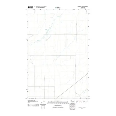
2011 Map of Cormana Lake
USGS Topo · Published 2011About this map
Cormana Lake and the seasonally shifting waters of Duck Creek define this agricultural landscape in Lincoln County. The 2011 survey reveals a region structured by a systematic grid of gravel and dirt roads, many of which bear the names of local families and historic transit routes. This includes Huddle Corner Rd E, Cain Rd N, and Old Johnson Rd N, indicating a deep-rooted pattern of rural land ownership. The presence of Swenson Lake further illustrates the complex drainage patterns of the Washington scablands. These features, along with Coal Creek in the southeast, provide a clear view of the area's hydrology and transportation network during the early 21st century, making it a valuable resource for tracing property boundaries and natural land features.
Find a feature on this map
18 named features on this map. Tap any name to fly to it.
Don’t see what you’re looking for? This feature index may not catch every label — zoom into the map to look around manually.
Map Details
Editions of this 2011 Cormana Lake Map
This is the sole edition of this map. No revisions or reprints were ever made.
Other maps of this area

1953 · Ritzville
USGS Topo · 1:250,000

1959 · Ritzville
USGS Topo · 1:250,000

1965 · Ritzville
USGS Topo · 1:250,000

1968 · Sylvan Lake
USGS Topo · 1:24,000

1968 · Coffeepot Lake
USGS Topo · 1:24,000

1969 · Rocklyn SW
USGS Topo · 1:24,000

1969 · Harrington
USGS Topo · 1:24,000

1969 · Cormana Lake
USGS Topo · 1:24,000

1969 · Lamona
USGS Topo · 1:24,000
1969 · Rocklyn SE
USGS Topo · 1:24,000