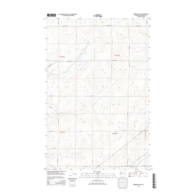
2013 Map of Cormana Lake
USGS Topo · Published 2013About this map
Cormana Lake and its surrounding high plateau terrain characterize this portion of Lincoln County during the early 21st century. The landscape is defined by a dense network of sectional roads and drainages, where Duck Cr and Swenson Lake sit amidst an expansive agricultural and ranching grid. Evidence of the region’s transit and water management history is visible in the alignment of Wa-28 and the presence of Coal Cr near the settlement of Downs.
Find a feature on this map
29 named features on this map. Tap any name to fly to it.
Don’t see what you’re looking for? This feature index may not catch every label — zoom into the map to look around manually.
Map Details
Editions of this 2013 Cormana Lake Map
This is the sole edition of this map. No revisions or reprints were ever made.
Other maps of this area

1953 · Ritzville
USGS Topo · 1:250,000

1959 · Ritzville
USGS Topo · 1:250,000

1965 · Ritzville
USGS Topo · 1:250,000

1968 · Sylvan Lake
USGS Topo · 1:24,000

1968 · Coffeepot Lake
USGS Topo · 1:24,000

1969 · Rocklyn SW
USGS Topo · 1:24,000

1969 · Harrington
USGS Topo · 1:24,000

1969 · Cormana Lake
USGS Topo · 1:24,000

1969 · Lamona
USGS Topo · 1:24,000
1969 · Rocklyn SE
USGS Topo · 1:24,000