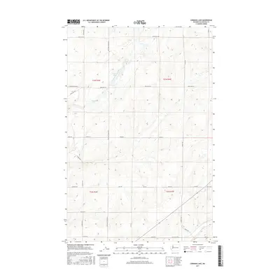
2017 Map of Cormana Lake
USGS Topo · Published 2017About this map
Cormana Lake and Swenson Lake sit within a landscape of carved glacial drainages and coulees in Lincoln County. This 2017 survey shows a region defined by its topography, where the Coal Coulee draws a distinct line across the southern landscape near Kaputa Rd E. The map reveals a highly structured grid of section lines and rural thoroughfares, reflecting the systematic land division of the Pacific Northwest. Waterways like Duck Cr and Coal Cr follow the natural depressions between the plateaus, while an extensive network of family-named or descriptive roads, such as Huddle Corner Rd E and Coffee Pot Rd E, connects the scattered farmsteads of the Big Bend country. The drainage patterns of the Duck Cr basin provide a clear view of how water and terrain have historically dictated movement and land use in this part of Washington.
Find a feature on this map
31 named features on this map. Tap any name to fly to it.
Don’t see what you’re looking for? This feature index may not catch every label — zoom into the map to look around manually.
Map Details
Editions of this 2017 Cormana Lake Map
This is the sole edition of this map. No revisions or reprints were ever made.
Other maps of this area

1953 · Ritzville
USGS Topo · 1:250,000

1959 · Ritzville
USGS Topo · 1:250,000

1965 · Ritzville
USGS Topo · 1:250,000

1968 · Sylvan Lake
USGS Topo · 1:24,000

1968 · Coffeepot Lake
USGS Topo · 1:24,000

1969 · Rocklyn SW
USGS Topo · 1:24,000

1969 · Harrington
USGS Topo · 1:24,000

1969 · Cormana Lake
USGS Topo · 1:24,000

1969 · Lamona
USGS Topo · 1:24,000
1969 · Rocklyn SE
USGS Topo · 1:24,000