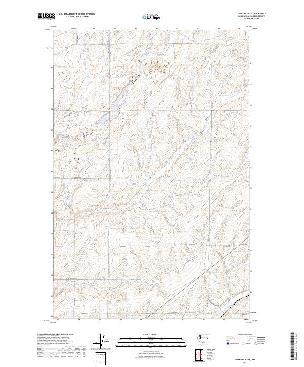
2023 Map of Cormana Lake
USGS Topo · Published 2023About this map
Duck Creek winds through this section of Lincoln County, defining the drainage patterns of an agricultural landscape shaped by coulees and prairie. The terrain is marked by seasonal water features like Swenson Lake and the southern flow of Coal Creek. A dense network of local roads, such as Huddle Corner Rd E and Duck Lake Lamona Rd N, reflects the long-standing land divisions and property access routes of this rural corridor. This modern survey demonstrates the persistence of family-named thoroughfares like Salo Rd and Kaputa Rd E, which trace the paths established by early settlers in the region. The map highlights the intersection of natural coulee formations with the rectilinear grid of the Public Land Survey System, specifically across t23n r34e and t23n r35e.
Find a feature on this map
30 named features on this map. Tap any name to fly to it.
Don’t see what you’re looking for? This feature index may not catch every label — zoom into the map to look around manually.
Map Details
Editions of this 2023 Cormana Lake Map
This is the sole edition of this map. No revisions or reprints were ever made.
Other maps of this area

1953 · Ritzville
USGS Topo · 1:250,000

1959 · Ritzville
USGS Topo · 1:250,000

1965 · Ritzville
USGS Topo · 1:250,000

1968 · Sylvan Lake
USGS Topo · 1:24,000

1968 · Coffeepot Lake
USGS Topo · 1:24,000

1969 · Rocklyn SW
USGS Topo · 1:24,000

1969 · Harrington
USGS Topo · 1:24,000

1969 · Cormana Lake
USGS Topo · 1:24,000

1969 · Lamona
USGS Topo · 1:24,000
1969 · Rocklyn SE
USGS Topo · 1:24,000