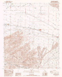
1986 Map of Corn Spring
USGS Topo · Published 1986About this map
Chuckwalla Mountains dominate the southern half of this landscape, giving way to the wide desert expanse of the Chuckwalla Valley to the north. Water management and resource extraction define human presence in this arid environment during the mid-1980s. The presence of Aztec Well Graves and the historic Gruendikes Well (Site) point to the critical importance of reliable water sources for early desert travelers and settlers. While the northern section shows modern infrastructure like a Transmission Line, a long Pipeline, and a small Trailer Park, the southern mountains remain characterized by isolated Prospect workings and the riparian oasis of Corn Spring. This area serves as a focal point with a nearby Campground, illustrating the shift from early subsistence and mining towards recreational use of the desert. Mapping of numerous Dike segments and Wash patterns reveals the complex drainage required to protect roads and infrastructure from flash flooding.
Find a feature on this map
27 named features on this map. Tap any name to fly to it.
Don’t see what you’re looking for? This feature index may not catch every label — zoom into the map to look around manually.
Map Details
Editions of this 1986 Corn Spring Map
This is the sole edition of this map. No revisions or reprints were ever made.
Other maps of this area

1943 · Coxcomb Mountains
USGS Topo · 1:62,500

1944 · Chuckwalla Mountains
USGS Topo · 1:62,500

1944 · Coxcomb Mountains
USGS Topo · 1:62,500

1952 · Sidewinder Well
USGS Topo · 1:62,500

1952 · Palen Mountains
USGS Topo · 1:62,500

1954 · Salton Sea
USGS Topo · 1:250,000

1955 · Salton Sea
USGS Topo · 1:250,000

1959 · Salton Sea
USGS Topo · 1:250,000

1963 · Salton Sea
USGS Topo · 1:250,000

1963 · Chuckwalla Mountains
USGS Topo · 1:62,500