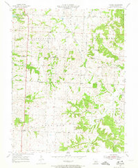
1955 Map of Cornelia
USGS Topo · Published 1974About this map
Bristle Ridge dominates the upper reaches of this Johnson County landscape, where the terrain transitions into the forested margins of Knob Noster State Park. In the mid-1950s, this area was defined by a network of rural townships including Warrensburg, Montserrat, and Post Oak, anchored by small communities like Cornelia and Bowmansville. The map illustrates a deeply rooted social geography, with local schools such as Valley Sch and Adams Sch serving family farms connected by winding creeks like Bear Creek and Clear Creek.
Find a feature on this map
33 named features on this map. Tap any name to fly to it.
Don’t see what you’re looking for? This feature index may not catch every label — zoom into the map to look around manually.
Map Details
Editions of this 1955 Cornelia Map
3 editions found
Other maps of this area

1885 · Warrensburg
USGS Topo · 1:125,000

1887 · Warrensburg
USGS Topo · 1:125,000

1894 · Warrensburg
USGS Topo · 1:125,000

1917 · Knobnoster
USGS Topo · 1:62,500

1947 · Jefferson City
USGS Topo · 1:250,000

1954 · Jefferson City
USGS Topo · 1:250,000

1954 · Centerview
USGS Topo · 1:24,000
1955 · Leeton
USGS Topo · 1:24,000
1955 · Windsor
USGS Topo · 1:24,000

1955 · Cornelia
USGS Topo · 1:24,000