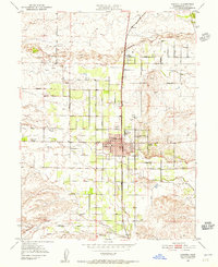
1951 Map of Corning
USGS Topo · Published 1956About this map
Corning sits at the heart of this mid-century Tehama County landscape, defined by a rigid grid of agricultural roads and the vital corridor of the Southern Pacific railroad. The map documents a transition in local infrastructure, noting several gas wells scattered through the eastern hills and a abandoned reservoir near the municipal center. Educational and civic life are anchored by the Union High School and the Independent School to the west, while the northern settlement of Richfield borders the broad bed of Thomes Creek. The survey captures an era of post-war utility, showing the placement of numerous windmills and reservoirs across the plains, which support the orchards and fields bounded by Finnell Ave and Liberal Avenue. From the Municipal Airport to the western Stone House, the terrain is meticulously partitioned into sections, illustrating the organized growth of California’s Central Valley during the early 1950s.
Find a feature on this map
39 named features on this map. Tap any name to fly to it.
Don’t see what you’re looking for? This feature index may not catch every label — zoom into the map to look around manually.
Map Details
Editions of this 1951 Corning Map
4 editions found
Other maps of this area

1890 · Red Bluff
USGS Topo · 1:250,000

1894 · Red Bluff
USGS Topo · 1:250,000

1904 · Vina
USGS Topo · 1:62,500

1905 · Tehama
USGS Topo · 1:62,500

1914 · Kirkwood
USGS Topo · 1:31,680

1914 · McIntosh Landing
USGS Topo · 1:31,680

1944 · Flournoy
USGS Topo · 1:62,500
1949 · Kirkwood
USGS Topo · 1:24,000
1950 · Kirkwood
USGS Topo · 1:24,000
1950 · Vina
USGS Topo · 1:24,000