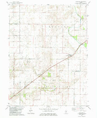
1982 Map of Cornland
USGS Topo · Published 1984About this map
Cornland and the surrounding prairie of Central Illinois dominate this 1980s landscape, positioned along the diagonal route of the Illinois Central Gulf railroad. The map highlights the agricultural heart of the region, where the boundary between Logan and Sangamon Counties cuts through fertile farmland. Near the settlement of Buffalo Hart, local heritage is preserved at the Buffalo Hart Ch and the nearby Township Cem. The drainage patterns are defined by the Lake Fork, which meanders through the eastern sections of Elkhart and Buffalo Hart townships. Several family and community burial grounds, such as Turley Cem and Constant Cem, are scattered across the quadrangle, offering specific points of interest for genealogists tracing early residents of these rural townships.
Find a feature on this map
14 named features on this map. Tap any name to fly to it.
Don’t see what you’re looking for? This feature index may not catch every label — zoom into the map to look around manually.
Map Details
Editions of this 1982 Cornland Map
2 editions found
Other maps of this area

1907 · Springfield
USGS Topo · 1:62,500

1911 · Lincoln
USGS Topo · 1:62,500

1913 · Lincoln
USGS Topo · 1:62,500

1930 · Springfield
USGS Topo · 1:62,500

1940 · Springfield
USGS Topo · 1:62,500

1948 · Mason City
USGS Topo · 1:62,500

1949 · Mason City
USGS Topo · 1:62,500

1950 · Springfield East
USGS Topo · 1:24,000

1954 · Mechanicsburg
USGS Topo · 1:62,500

1958 · Peoria
USGS Topo · 1:250,000