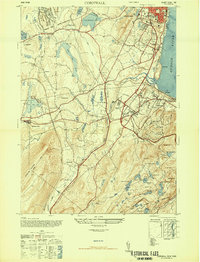
1947 Map of Cornwall
USGS Topo · Published 1947About this map
Newburgh and Cornwall anchor this postwar landscape, defined by a heavy military presence and a complex network of transportation. In the years immediately following World War II, the Stewart Field Military Reservation and Stewart AAF occupy the northwest, while the West Point Military Reservation dominates the rugged southern terrain around Mt Rascal and Round Pond.
Find a feature on this map
61 named features on this map. Tap any name to fly to it.
Don’t see what you’re looking for? This feature index may not catch every label — zoom into the map to look around manually.
Map Details
Editions of this 1947 Cornwall Map
2 editions found
Other maps of this area

1892 · West Point
USGS Topo · 1:62,500

1893 · Poughkeepsie
USGS Topo · 1:62,500

1894 · West Point
USGS Topo · 1:62,500

1894 · Poughkeepsie
USGS Topo · 1:62,500

1899 · West Point
USGS Topo · 1:62,500

1901 · West Point
USGS Topo · 1:62,500

1902 · Schunemunk
USGS Topo · 1:62,500

1903 · Poughkeepsie
USGS Topo · 1:62,500

1903 · Newburg
USGS Topo · 1:62,500

1930 · Schunemunk
USGS Topo · 1:48,000