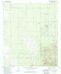
1981 Map of Corona De Tucson
USGS Topo · Published 1986About this map
Corona de Tucson sits at a geographic transition where the Santa Cruz Valley floor meets the rising foothills of the Santa Rita Mountains. During the early 1980s, this area was defined by a mix of scientific research, military utility, and extractive industry. To the south, the Santa Rita Experimental Range and Wildlife Area occupies much of the landscape, established long before this survey for ecological study. The northeastern portion of the sheet shows the expanding residential footprint of Corona de Tucson, bordered by major corridors like Houghton Road.
Find a feature on this map
16 named features on this map. Tap any name to fly to it.
Don’t see what you’re looking for? This feature index may not catch every label — zoom into the map to look around manually.
Map Details
Editions of this 1981 Corona De Tucson Map
2 editions found
Other maps of this area

1904 · Patagonia
USGS Topo · 1:125,000

1904 · Tucson
USGS Topo · 1:125,000

1905 · Patagonia
USGS Topo · 1:125,000

1905 · Tucson
USGS Topo · 1:125,000

1926 · Helvetia
USGS Topo · 1:62,500

1948 · Tucson
USGS Topo · 1:62,500

1956 · Nogales
USGS Topo · 1:250,000

1956 · Tucson
USGS Topo · 1:250,000

1957 · Tucson
USGS Topo · 1:62,500

1957 · Rincon Valley
USGS Topo · 1:62,500