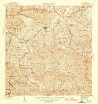
1946 Map of Corozal
USGS Topo · Published 1946About this map
Corozal serves as the focal point of this mid-century survey, situated at the confluence of the Río Cibuco and Río Corozal. The 1940s landscape is defined by its agricultural and social infrastructure, evidenced by numerous rural schools like the Escuela Segunda Unidad de Palmarejo and the Escuela Vocacional Dr Jose Padin. Spiritual life is centered at the Iglesia de la Inmaculada Concepción and Iglesia La Milagrosa, while the Acueducto de Corozal highlights the era's development of public utilities. The terrain is deeply dissected by a network of waterways including the Río Grande de Manatí and the uniquely named Quebrada de los Muertos. This document captures the intricate system of barrios and municipios that organized the region, from Dos Bocas to Palos Blancos, before modern highway expansions altered the traditional interior routes.
Find a feature on this map
64 named features on this map. Tap any name to fly to it.
Don’t see what you’re looking for? This feature index may not catch every label — zoom into the map to look around manually.
Map Details
Editions of this 1946 Corozal Map
3 editions found
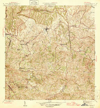
Other maps of this area

1940 · Vega Alta
USGS Topo · 1:30,000

1941 · Bayamon
USGS Topo · 1:30,000

1942 · Manati
USGS Topo · 1:30,000

1946 · Corozal
USGS Topo · 1:30,000

1946 · Barranquitas
USGS Topo · 1:30,000

1946 · Ciales
USGS Topo · 1:30,000

1946 · Vega Alta
USGS Topo · 1:30,000

1946 · Comerio
USGS Topo · 1:30,000

1946 · Naranjito
USGS Topo · 1:30,000

1946 · Manati
USGS Topo · 1:30,000
Featured Places
- Corozal
- Sunflower Valley, Toa Alta
- Los Pelusa, Naranjito
- Reparto Pérez, Toa Alta
- Sector Rolo Barrera, Corozal