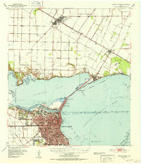
1951 Map of Corpus Christi
USGS Topo · Published 1952This historical map portrays the area of Corpus Christi in 1951, primarily covering Nueces County as well as portions of San Patricio County. Featuring a scale of 1:62500, this map provides a highly detailed snapshot of the terrain, roads, buildings, counties, and historical landmarks in the Corpus Christi region at the time. Published in 1952, it is one of 2 known editions of this map due to revisions or reprints.
Find a feature on this map
54 named features on this map. Tap any name to fly to it.
Don’t see what you’re looking for? This feature index may not catch every label — zoom into the map to look around manually.
Map Details
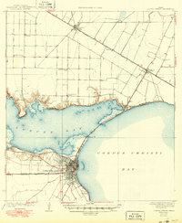
Editions of this 1951 Corpus Christi Map
2 editions found
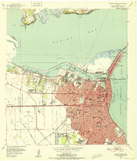
Historical Maps of Second Roosevelt Colonia Through Time
10 maps found
1925 Corpus Christi
Nueces County, TX

1950 Corpus Christi
Nueces County, TX
1951 Corpus Christi
Nueces County, TX

1951 Corpus Christi
Nueces County, TX

1956 Corpus Christi
Nueces County, TX

1960 Corpus Christi
Nueces County, TX

1966 Corpus Christi
Nueces County, TX
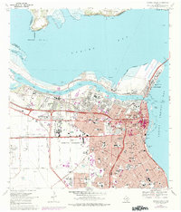
1968 Corpus Christi
Nueces County, TX

1984 Corpus Christi
Nueces County, TX

1989 Corpus Christi
Nueces County, TX