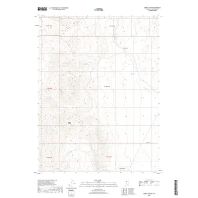
2018 Map of Corral Canyon
USGS Topo · Published 2018About this map
Dead Ox Canyon and Corral Canyon dominate this high-elevation terrain in the central Basin and Range province. This 2018 survey reveals a landscape defined by seasonal water systems, where the drainage of Corral Canyon Cr and the wide expanse of Grass Valley meet the steep slopes of the Shoshone Mountains. The mapping of perennial water sources like Rocky Mountain Spring Number One and Corral Spring highlights the critical importance of these features in an otherwise arid environment. The network of washes, including Dry Canyon Wash, illustrates the erosional patterns that have shaped these canyons over time. This quadrangle provides a detailed view of the public land survey system divisions across townships T23N through T25N, offering a precise look at the geography of Lander County before modern development impacted these remote reaches.
Find a feature on this map
16 named features on this map. Tap any name to fly to it.
Don’t see what you’re looking for? This feature index may not catch every label — zoom into the map to look around manually.
Map Details
Editions of this 2018 Corral Canyon Map
This is the sole edition of this map. No revisions or reprints were ever made.
Other maps of this area

1926 · Roberts Mountains
USGS Topo · 1:250,000

1929 · Roberts Mountains
USGS Topo · 1:250,000

1938 · Cortez
USGS Topo · 1:48,000

1944 · Cortez
USGS Topo · 1:62,500

1955 · Millett
USGS Topo · 1:250,000

1955 · Winnemucca
USGS Topo · 1:250,000

1956 · Walti Hot Springs
USGS Topo · 1:62,500

1956 · Hall Creek
USGS Topo · 1:62,500

1958 · Winnemucca
USGS Topo · 1:250,000

1959 · Millett
USGS Topo · 1:250,000