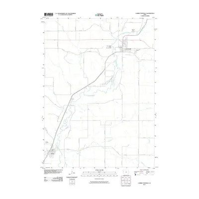
2010 Map of Correctionville
USGS Topo · Published 2010About this map
The Little Sioux River meanders through the heart of this Woodbury County landscape, carving a wide valley that defines the local geography. The town of Correctionville sits at a significant bend in the river, served by the Correctionville Post Office and bordered to the east by the Correctionville Cemetery. Further south, the settlement of Anthon anchors the lower portion of the map near the confluence of Wolf Creek and the river, featuring its own Anthon Post Office and the nearby Oak Hill Cemetery.
Find a feature on this map
35 named features on this map. Tap any name to fly to it.
Don’t see what you’re looking for? This feature index may not catch every label — zoom into the map to look around manually.
Map Details
Editions of this 2010 Correctionville Map
This is the sole edition of this map. No revisions or reprints were ever made.
Other maps of this area

1954 · Fort Dodge
USGS Topo · 1:250,000

1957 · Fort Dodge
USGS Topo · 1:250,000

1958 · Fort Dodge
USGS Topo · 1:250,000

1969 · Holstein SW
USGS Topo · 1:24,000

1969 · Pierson
USGS Topo · 1:24,000

1969 · Correctionville NW
USGS Topo · 1:24,000

1969 · Correctionville
USGS Topo · 1:24,000
1969 · Kingsley
USGS Topo · 1:24,000

1969 · Cushing
USGS Topo · 1:24,000
1969 · Oto
USGS Topo · 1:24,000