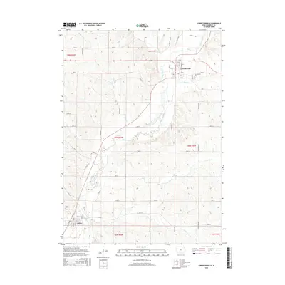
2015 Map of Correctionville
USGS Topo · Published 2015About this map
Correctionville and Anthon anchor this Woodbury County landscape, where the meandering Little Sioux River dictates the local topography and settlement patterns. The river valley is a primary geographical feature, drawing in numerous tributaries including Threemile Cr, Pierson Cr, and Bacon Cr. The map reveals a structured grid of rural roads, such as 150th St and Lenox Ave, that segment the agricultural sections across several townships. Genealogists will find the Correctionville Cem and Oak Hill Cem clearly marked near their respective towns. Notable recreational or transit corridors like the Wolf Creek Trl and Wolf Creek Trce follow the natural contours of the valley, illustrating how contemporary land use continues to interact with the river's historic drainage basin, which also includes Coon Cr and Big Cr to the south.
Find a feature on this map
37 named features on this map. Tap any name to fly to it.
Don’t see what you’re looking for? This feature index may not catch every label — zoom into the map to look around manually.
Map Details
Editions of this 2015 Correctionville Map
This is the sole edition of this map. No revisions or reprints were ever made.
Other maps of this area

1954 · Fort Dodge
USGS Topo · 1:250,000

1957 · Fort Dodge
USGS Topo · 1:250,000

1958 · Fort Dodge
USGS Topo · 1:250,000

1969 · Holstein SW
USGS Topo · 1:24,000

1969 · Pierson
USGS Topo · 1:24,000

1969 · Correctionville NW
USGS Topo · 1:24,000

1969 · Correctionville
USGS Topo · 1:24,000
1969 · Kingsley
USGS Topo · 1:24,000

1969 · Cushing
USGS Topo · 1:24,000
1969 · Oto
USGS Topo · 1:24,000