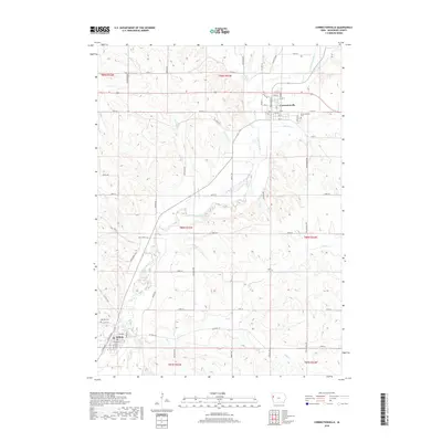
2018 Map of Correctionville
USGS Topo · Published 2018About this map
The Little Sioux River meanders through the heart of this Woodbury County landscape, shaping the development of Correctionville in the north and Anthon in the southwest. This modern topographical record shows a highly organized rural grid defined by roads like Minnesota Ave and Michigan Ave, which bridge the undulating terrain between various tributaries. The waterway network is dense, featuring Threemile Cr, Pierson Cr, and Bacon Cr feeding into the main river valley. Local history is anchored by the Correctionville Cem and Oak Hill Cem, while the recreational character of the valley is highlighted by the Wolf Creek Trl and Wolf Creek Trce. The map illustrates a stable agricultural region where the natural drainage of Coon Cr and Big Cr dictates the layout of modern county transit routes.
Find a feature on this map
58 named features on this map. Tap any name to fly to it.
Don’t see what you’re looking for? This feature index may not catch every label — zoom into the map to look around manually.
Map Details
Editions of this 2018 Correctionville Map
This is the sole edition of this map. No revisions or reprints were ever made.
Other maps of this area

1954 · Fort Dodge
USGS Topo · 1:250,000

1957 · Fort Dodge
USGS Topo · 1:250,000

1958 · Fort Dodge
USGS Topo · 1:250,000

1969 · Holstein SW
USGS Topo · 1:24,000

1969 · Pierson
USGS Topo · 1:24,000

1969 · Correctionville NW
USGS Topo · 1:24,000

1969 · Correctionville
USGS Topo · 1:24,000
1969 · Kingsley
USGS Topo · 1:24,000

1969 · Cushing
USGS Topo · 1:24,000
1969 · Oto
USGS Topo · 1:24,000