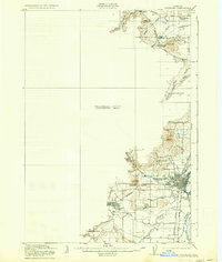
1921 Map of Corvallis
USGS Topo · Published 1937About this map
Corvallis and the surrounding Willamette Valley landscape are defined here by a robust early 20th-century transportation and education network. The campus of Oregon State College anchors the settlement, while the Southern Pacific and Oregon Electric railroads intersect near the city center, facilitating the regional movement of goods and people. To the west, the community of Philomath sits near the winding course of Mary's River, connected to the county seat by established thoroughfares.
Find a feature on this map
36 named features on this map. Tap any name to fly to it.
Don’t see what you’re looking for? This feature index may not catch every label — zoom into the map to look around manually.
Map Details
Editions of this 1921 Corvallis Map
5 editions found
Other maps of this area

1911 · Inavale
USGS Topo · 1:31,680

1912 · Halsey
USGS Topo · 1:62,500

1913 · Philomath
USGS Topo · 1:31,680

1913 · Oakville
USGS Topo · 1:31,680

1913 · Wells
USGS Topo · 1:31,680

1914 · Independence
USGS Topo · 1:31,680

1914 · Soap Creek
USGS Topo · 1:31,680

1916 · Albany
USGS Topo · 1:62,500

1917 · Salem
USGS Topo · 1:62,500

1921 · Corvallis
USGS Topo · 1:62,500