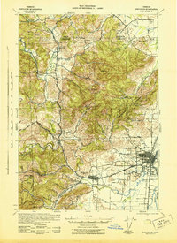
1942 Map of Corvallis
USGS Topo · Published 1942About this map
Oregon State College anchors the eastern edge of this landscape, where the campus and the growing city of Corvallis meet the agricultural and timbered foothills of the Coast Range. In the early 1940s, the region was defined by a dense network of rural school districts and small logging outposts, including Simpsons Camp and the timberlands of the Siletz National Forest. The Marys River and its tributaries, such as Muddy Creek and Oak Creek, dictate the valley's drainage and historical settlement patterns, with the town of Philomath serving as a central hub for the surrounding countryside. Moving north into Polk and Benton Counties, the terrain transitions into the steep slopes of Forest Peak and Smith Hill. This survey captures the transition of the Willamette Valley’s western edge before post-war expansion, preserving the locations of numerous vanished rural institutions like the Valley View Sch and Ward Sch.
Find a feature on this map
60 named features on this map. Tap any name to fly to it.
Don’t see what you’re looking for? This feature index may not catch every label — zoom into the map to look around manually.
Map Details
Editions of this 1942 Corvallis Map
3 editions found

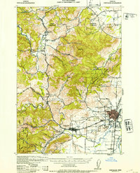
Other maps of this area

1911 · Inavale
USGS Topo · 1:31,680

1912 · Halsey
USGS Topo · 1:62,500

1913 · Philomath
USGS Topo · 1:31,680

1913 · Oakville
USGS Topo · 1:31,680

1913 · Wells
USGS Topo · 1:31,680

1914 · Independence
USGS Topo · 1:31,680

1914 · Soap Creek
USGS Topo · 1:31,680

1916 · Albany
USGS Topo · 1:62,500

1917 · Salem
USGS Topo · 1:62,500

1921 · Corvallis
USGS Topo · 1:62,500