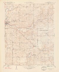
1948 Map of Corydon East
USGS Topo · Published 1948About this map
Corydon and its eastern environs in Harrison County appear in significant detail just after the war, showing a landscape defined by the winding paths of Indian Creek and its many tributaries. The area is marked by a high density of rural community centers, from the Harrison Grange to small settlements like New Middletown and Breckenridge. This mid-century survey is particularly valuable for genealogists, as it preserves the locations of numerous family-named landmarks and resting places, including the Warren Cem, David Charley Cem, and Musselman Cem.
Find a feature on this map
25 named features on this map. Tap any name to fly to it.
Don’t see what you’re looking for? This feature index may not catch every label — zoom into the map to look around manually.
Map Details
Editions of this 1948 Corydon East Map
2 editions found
Other maps of this area

1909 · Kosmosdale
USGS Topo · 1:48,000

1912 · Kosmosdale
USGS Topo · 1:62,500

1931 · Corydon
USGS Topo · 1:62,500

1939 · Georgetown
USGS Topo · 1:24,000

1944 · Corydon West
USGS Topo · 1:24,000

1946 · Depauw
USGS Topo · 1:24,000

1947 · Georgetown
USGS Topo · 1:24,000

1947 · Corydon West
USGS Topo · 1:24,000

1947 · Mauckport
USGS Topo · 1:24,000

1948 · Corydon East
USGS Topo · 1:24,000