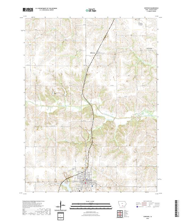
2022 Map of Corydon
USGS Topo · Published 2022About this map
The Wayne County Courthouse stands as the central landmark of Corydon, the primary settlement in this part of southern Iowa. The town's grid is well-defined by local streets like W Depot St and E Hancock St, with the Corydon Cem located on the southern edge. The surrounding rural landscape is characterized by a network of creeks, including Wildcat Cr and Jordan Cr, which flow toward the S Fork Chariton River. This river corridor creates a distinct east-west break in the township grids of t70n r22w and t69n r22w. Smaller hamlets like Millerton and the uniquely named New York appear along the northern roads, while the Hogue Cem provides a point of genealogical interest in the open country between settlements. The presence of the Moore Private Airport in the northeast corner reflects the modern utility of the flat prairie uplands.
Find a feature on this map
61 named features on this map. Tap any name to fly to it.
Don’t see what you’re looking for? This feature index may not catch every label — zoom into the map to look around manually.
Map Details
Editions of this 2022 Corydon Map
This is the sole edition of this map. No revisions or reprints were ever made.
Other maps of this area

1934 · Humeston
USGS Topo · 1:48,000

1935 · Russell
USGS Topo · 1:62,500

1937 · Corydon
USGS Topo · 1:62,500

1938 · Russell
USGS Topo · 1:62,500

1942 · Seymour
USGS Topo · 1:62,500

1944 · Seymour
USGS Topo · 1:62,500

1954 · Centerville
USGS Topo · 1:250,000

1957 · Centerville
USGS Topo · 1:250,000

1958 · Centerville
USGS Topo · 1:250,000

1964 · Allerton
USGS Topo · 1:24,000