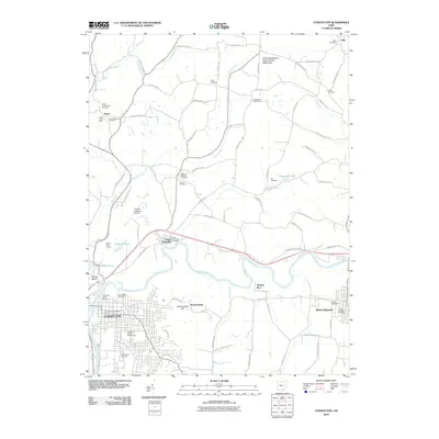
2010 Map of Coshocton
USGS Topo · Published 2010About this map
Coshocton and West Lafayette anchor this region where the Tuscarawas River and Muskingum River converge. The landscape is defined by its industrial and civic infrastructure, including the Coshocton Water Works and the expansive Coshocton County Fairgrounds. To the north, the North Appalachian Experimental Watershed reflects the area's agricultural and scientific research history, while smaller settlements like Keene and Chili dot the highlands.
Find a feature on this map
88 named features on this map. Tap any name to fly to it.
Don’t see what you’re looking for? This feature index may not catch every label — zoom into the map to look around manually.
Map Details
Editions of this 2010 Coshocton Map
This is the sole edition of this map. No revisions or reprints were ever made.
Other maps of this area

1908 · Conesville
USGS Topo · 1:62,500

1909 · Cambridge
USGS Topo · 1:62,500

1910 · Conesville
USGS Topo · 1:62,500

1911 · Newcomerstown
USGS Topo · 1:62,500

1912 · Cambridge
USGS Topo · 1:62,500

1913 · Newcomerstown
USGS Topo · 1:62,500

1913 · Coshocton
USGS Topo · 1:62,500

1915 · Coshocton
USGS Topo · 1:62,500

1943 · Coshocton
USGS Topo · 1:62,500

1943 · Newcomerstown
USGS Topo · 1:62,500