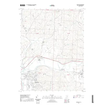
2019 Map of Coshocton
USGS Topo · Published 2019About this map
Coshocton serves as the regional anchor on this survey, situated where the Walhonding River and Tuscarawas River converge to form the Muskingum River. This confluence has long defined the geography of the area, as evidenced by the series of basins like Roscoe Basin, Mudport Basin, and Middle Basin that line the river corridors. The town's civic heart is marked by the Coshocton County Courthouse, while the surrounding landscape is dotted with small rural nodes like Keene and Canal-Lewisville.
Find a feature on this map
143 named features on this map. Tap any name to fly to it.
Don’t see what you’re looking for? This feature index may not catch every label — zoom into the map to look around manually.
Map Details
Editions of this 2019 Coshocton Map
This is the sole edition of this map. No revisions or reprints were ever made.
Other maps of this area

1908 · Conesville
USGS Topo · 1:62,500

1909 · Cambridge
USGS Topo · 1:62,500

1910 · Conesville
USGS Topo · 1:62,500

1911 · Newcomerstown
USGS Topo · 1:62,500

1912 · Cambridge
USGS Topo · 1:62,500

1913 · Newcomerstown
USGS Topo · 1:62,500

1913 · Coshocton
USGS Topo · 1:62,500

1915 · Coshocton
USGS Topo · 1:62,500

1943 · Coshocton
USGS Topo · 1:62,500

1943 · Newcomerstown
USGS Topo · 1:62,500