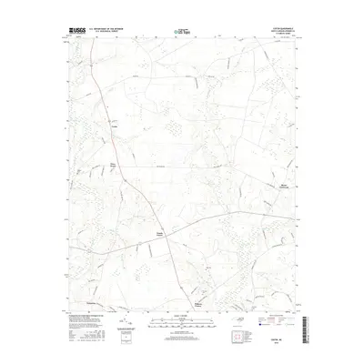
2016 Map of Costin
USGS Topo · Published 2016About this map
Moores Cr and Cypress Cr define the hydrological character of this Pender County landscape, where small agricultural settlements are clustered around key intersections and drainages. The area is marked by numerous family-named landmarks and cemeteries, such as Walker Cem, Page Cem, and Herring Cem, which offer significant value for genealogical research. Communities like Costin, Piney Wood, and Wards Corner serve as local hubs, connected by a network of rural roads such as Shiloh Rd and Piney Woods Rd. To the south, Malpass Corner and Yamacraw show the continued importance of these named crossroads in the regional geography. The map also identifies distinct water features including The Lake and several branches like Bear Den Br and White Oak Br, illustrating the intricate drainage patterns of the coastal plain.
Find a feature on this map
62 named features on this map. Tap any name to fly to it.
Don’t see what you’re looking for? This feature index may not catch every label — zoom into the map to look around manually.
Map Details
Editions of this 2016 Costin Map
This is the sole edition of this map. No revisions or reprints were ever made.
Other maps of this area

1942 · Burgaw
USGS Topo · 1:62,500

1947 · Rocky Point
USGS Topo · 1:62,500

1953 · Florence
USGS Topo · 1:250,000

1953 · Beaufort
USGS Topo · 1:250,000

1954 · Florence
USGS Topo · 1:250,000

1954 · Beaufort
USGS Topo · 1:250,000

1954 · Acme
USGS Topo · 1:62,500

1955 · Atkinson
USGS Topo · 1:62,500
1970 · Rocky Point
USGS Topo · 1:24,000

1972 · Beaufort
USGS Topo · 1:250,000