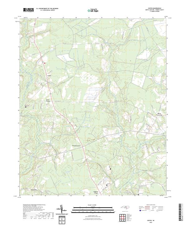
2022 Map of Costin
USGS Topo · Published 2022About this map
Cypress Creek and its many winding tributaries, including Bee Branch and Buxton Branch, define the low-lying drainage patterns of this Pender County landscape. The area is characterized by a network of rural crossroads and small communities that have persisted through the early 21st century. Costin and Piney Wood sit along the primary north-south corridor, while Wards Corner and Malpass Corner anchor the southern portion of the sheet.
Find a feature on this map
62 named features on this map. Tap any name to fly to it.
Don’t see what you’re looking for? This feature index may not catch every label — zoom into the map to look around manually.
Map Details
Editions of this 2022 Costin Map
This is the sole edition of this map. No revisions or reprints were ever made.
Other maps of this area

1942 · Burgaw
USGS Topo · 1:62,500

1947 · Rocky Point
USGS Topo · 1:62,500

1953 · Florence
USGS Topo · 1:250,000

1953 · Beaufort
USGS Topo · 1:250,000

1954 · Florence
USGS Topo · 1:250,000

1954 · Beaufort
USGS Topo · 1:250,000

1954 · Acme
USGS Topo · 1:62,500

1955 · Atkinson
USGS Topo · 1:62,500
1970 · Rocky Point
USGS Topo · 1:24,000

1972 · Beaufort
USGS Topo · 1:250,000