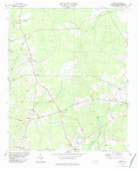
1984 Map of Costin
USGS Topo · Published 1984About this map
The low-lying coastal plains of Pender County are defined by a complex network of slow-moving waterways, including Moores Creek and Cypress Creek, which thread through the rural landscape. In the early 1980s, this area was characterized by a pattern of dispersed crossroads communities like Costin, Wards Corner, and Malpass Corner. The social fabric of the region is evident in the numerous country churches and schools, such as Shiloh Ch and West Pender Sch, which served as local anchors for the surrounding farmsteads.
Find a feature on this map
34 named features on this map. Tap any name to fly to it.
Don’t see what you’re looking for? This feature index may not catch every label — zoom into the map to look around manually.
Map Details
Editions of this 1984 Costin Map
This is the sole edition of this map. No revisions or reprints were ever made.
Other maps of this area

1942 · Burgaw
USGS Topo · 1:62,500

1947 · Rocky Point
USGS Topo · 1:62,500

1953 · Florence
USGS Topo · 1:250,000

1953 · Beaufort
USGS Topo · 1:250,000

1954 · Florence
USGS Topo · 1:250,000

1954 · Beaufort
USGS Topo · 1:250,000

1954 · Acme
USGS Topo · 1:62,500

1955 · Atkinson
USGS Topo · 1:62,500
1970 · Rocky Point
USGS Topo · 1:24,000

1972 · Beaufort
USGS Topo · 1:250,000