
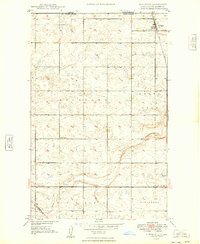
1948 Map of Coteau
USGS Topo · Published 1948About this map
The railroad town of Coteau serves as the focal point of this late 1940s survey, situated at a junction where the Minneapolis St. Paul and Sault Ste. Marie and Great Northern rail lines converge. The landscape is defined by the high, rolling terrain of the Missouri Coteau, marked by numerous small depressions and water bodies such as Shockley Slough. This survey captures a moment of local infrastructure that supported the rural community, including School No 1 and a Landing Field positioned west of the main settlement.
Find a feature on this map
15 named features on this map. Tap any name to fly to it.
Don’t see what you’re looking for? This feature index may not catch every label — zoom into the map to look around manually.
Map Details
Editions of this 1948 Coteau Map
This is the sole edition of this map. No revisions or reprints were ever made.
Other maps of this area

1947 · Bowbells NW
USGS Topo · 1:24,000

1947 · Flaxton
USGS Topo · 1:24,000

1947 · Bowbells
USGS Topo · 1:24,000

1948 · Flaxton
USGS Topo · 1:24,000

1948 · Woburn
USGS Topo · 1:24,000

1948 · Vanville NE
USGS Topo · 1:24,000

1949 · Bowbells
USGS Topo · 1:24,000

1949 · Bowbells NW
USGS Topo · 1:24,000

1949 · Niobe
USGS Topo · 1:24,000
1949 · Northgate
USGS Topo · 1:24,000