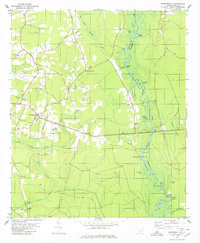
1980 Map of Cottageville
USGS Topo · Published 1980About this map
The Edisto River carves a winding path along the boundary of Colleton and Dorchester counties, serving as the central geographic feature of this South Carolina Lowcountry landscape. The riverfront is dotted with traditional access points such as Prices Landing, Goodhope Landing, and the historic Sullivans Ferry, reflecting a long-standing reliance on the waterway for transportation and local industry. Near the settlement of Cottageville, an Old Railroad Grade marks the path of former rail commerce, while the surrounding area is characterized by dense wetlands including Big Bay Swamp and Spooler Swamp.
Find a feature on this map
50 named features on this map. Tap any name to fly to it.
Don’t see what you’re looking for? This feature index may not catch every label — zoom into the map to look around manually.
Map Details
Editions of this 1980 Cottageville Map
2 editions found
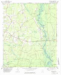
Other maps of this area

1918 · Walterboro
USGS Topo · 1:62,500

1918 · Cottageville
USGS Topo · 1:62,500

1919 · Ridgeville
USGS Topo · 1:48,000

1920 · Ridgeville
USGS Topo · 1:62,500

1920 · St. George
USGS Topo · 1:48,000

1921 · St. George
USGS Topo · 1:62,500

1943 · Cottageville
USGS Topo · 1:62,500

1943 · Orangeburg
USGS Topo · 1:125,000

1943 · Walterboro
USGS Topo · 1:62,500

1943 · Ridgeville
USGS Topo · 1:62,500