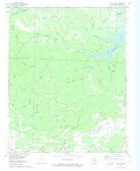
1972 Map of Cotter SW
USGS Topo · Published 1973About this map
Bull Shoals Lake dominates the northeastern terrain of this Marion County quadrangle, showing the controlled inundation areas along its jagged shoreline as they appeared in the early 1970s. The landscape is deeply incised by a network of named ridges and hollows, including Welcome Ridge and Wolfpen Ridge, which reflect the rugged topography of the Ozarks. The southern portion of the map centers on the settlement of Summit, situated along the Missouri Pacific railroad line. This area reveals a significant history of extraction, evidenced by numerous labeled sites like the Onwata Mine, Lost Bell Mine, and Erie Ozark Mine. These features, alongside local landmarks like The Rock House and the Welcome Ridge Ch, provide a detailed record of the mid-century rural economy and community structure in this part of Arkansas.
Find a feature on this map
53 named features on this map. Tap any name to fly to it.
Don’t see what you’re looking for? This feature index may not catch every label — zoom into the map to look around manually.
Map Details
Editions of this 1972 Cotter SW Map
2 editions found
Other maps of this area

1893 · Yellville
USGS Topo · 1:125,000

1903 · Yellville
USGS Topo · 1:125,000

1905 · Yellville
USGS Topo · 1:125,000

1929 · Yellville
USGS Topo · 1:125,000

1945 · Harrison
USGS Topo · 1:250,000

1949 · Harrison
USGS Topo · 1:250,000

1954 · Harrison
USGS Topo · 1:250,000

1958 · Harrison
USGS Topo · 1:250,000

1964 · Harrison
USGS Topo · 1:250,000
1966 · Yellville
USGS Topo · 1:24,000