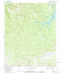
1972 Map of Cotter SW
USGS Topo · Published 1986About this map
Bull Shoals Lake dominates the northern reaches of this Marion County landscape, with underwater contours reflecting the topography before the valley was inundated. The map documents a rugged interior defined by ridges such as Welcome Ridge, Sunset Ridge, and Sharpy Jim Ridge, which separate a network of hollows and creek branches. Evidence of the region's extractive history is visible in the numerous mining operations scattered across the hills, including the Onwata Mine and Erie Ozark Mine.
Find a feature on this map
54 named features on this map. Tap any name to fly to it.
Don’t see what you’re looking for? This feature index may not catch every label — zoom into the map to look around manually.
Map Details
Editions of this 1972 Cotter SW Map
2 editions found
Other maps of this area

1893 · Yellville
USGS Topo · 1:125,000

1903 · Yellville
USGS Topo · 1:125,000

1905 · Yellville
USGS Topo · 1:125,000

1929 · Yellville
USGS Topo · 1:125,000

1945 · Harrison
USGS Topo · 1:250,000

1949 · Harrison
USGS Topo · 1:250,000

1954 · Harrison
USGS Topo · 1:250,000

1958 · Harrison
USGS Topo · 1:250,000

1964 · Harrison
USGS Topo · 1:250,000
1966 · Yellville
USGS Topo · 1:24,000