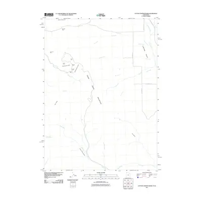
2011 Map of Cotton Thomas Basin
USGS Topo · Published 2011About this map
Vipont Mine and several other mining works occupy the high slopes of the Goose Creek Mountains on the Utah-Idaho border. This 2011 survey illustrates a remote landscape defined by narrow gulches and drainage basins, where mineral extraction left a permanent imprint. Deep tunnels and shafts like the Phelan Tunnel and Skoro Mine are situated near Pipe Spring Gulch and Horse Heaven Gulch, indicating a concentrated pocket of industrial activity in an otherwise high-desert wilderness.
Find a feature on this map
33 named features on this map. Tap any name to fly to it.
Don’t see what you’re looking for? This feature index may not catch every label — zoom into the map to look around manually.
Map Details
Editions of this 2011 Cotton Thomas Basin Map
This is the sole edition of this map. No revisions or reprints were ever made.
Other maps of this area

1954 · Pocatello
USGS Topo · 1:250,000

1954 · Brigham City
USGS Topo · 1:250,000

1958 · Pocatello
USGS Topo · 1:250,000

1958 · Brigham City
USGS Topo · 1:250,000

1959 · Cotton Thomas Basin
USGS Topo · 1:62,500

1959 · Yost
USGS Topo · 1:62,500

1962 · Brigham City
USGS Topo · 1:250,000

1968 · Almo
USGS Topo · 1:24,000
1968 · Blue Hill
USGS Topo · 1:24,000

1968 · Lyman Pass
USGS Topo · 1:24,000