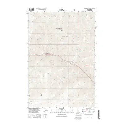
2013 Map of Cottontail Point
USGS Topo · Published 2013About this map
Polly Bemis Ranch and Shepp Ranch sit along the river corridor where the Nez Perce National Forest meets the Payette National Forest. This interior wilderness region is defined by sharp elevation changes between the high points of Arlington Ridge and the river-level Bull Creek Bar. The landscape is characterized by its steep drainages, including Whisky Bob Cr, Basin Cr, and Cottontail Cr, which feed into the primary river system. Historical landmarks named for local figures or terrain features are scattered across the quadrangle, from the heights of Jim Thrash Knob and Tomato Point to the lower elevation Republican Flats. The map also traces the Cross Trail, a primitive route that traverses the high ground of the forest interior.
Find a feature on this map
38 named features on this map. Tap any name to fly to it.
Don’t see what you’re looking for? This feature index may not catch every label — zoom into the map to look around manually.
Map Details
Editions of this 2013 Cottontail Point Map
This is the sole edition of this map. No revisions or reprints were ever made.
Other maps of this area

1931 · Buffalo Hump
USGS Topo · 1:125,000

1934 · Buffalo Hump
USGS Topo · 1:125,000

1956 · Burgdorf
USGS Topo · 1:62,500

1956 · Warren
USGS Topo · 1:62,500

1956 · Elk City
USGS Topo · 1:250,000

1960 · Elk City
USGS Topo · 1:250,000

1963 · Marble Butte
USGS Topo · 1:24,000

1977 · Silver Spur Ridge
USGS Topo · 1:24,000

1979 · Buffalo Hump
USGS Topo · 1:24,000

1981 · Warren
USGS Topo · 1:100,000