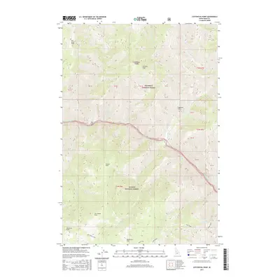
2017 Map of Cottontail Point
USGS Topo · Published 2017About this map
Salmon River carving through the heart of this landscape defines the boundary between the Nez Perce National Forest to the north and the Payette National Forest to the south. The drainage patterns of the era are intricately mapped, showing high-elevation points like Tomato Point and Sugarloaf Butte overlooking the river valley. The map reveals a remote network of forest infrastructure, including the Cross E Trails near Arlington Ridge and the Cottontail Point access road. Along the river's edge, features such as Bull Creek Bar indicate the shifting alluvial character of the watercourse. This survey records the intersection of multiple named drainages, from Whisky Bob Cr to the south-flowing Crooked Cr, providing a detailed view of the central Idaho backcountry before modern land-use changes.
Find a feature on this map
27 named features on this map. Tap any name to fly to it.
Don’t see what you’re looking for? This feature index may not catch every label — zoom into the map to look around manually.
Map Details
Editions of this 2017 Cottontail Point Map
This is the sole edition of this map. No revisions or reprints were ever made.
Other maps of this area

1931 · Buffalo Hump
USGS Topo · 1:125,000

1934 · Buffalo Hump
USGS Topo · 1:125,000

1956 · Burgdorf
USGS Topo · 1:62,500

1956 · Warren
USGS Topo · 1:62,500

1956 · Elk City
USGS Topo · 1:250,000

1960 · Elk City
USGS Topo · 1:250,000

1963 · Marble Butte
USGS Topo · 1:24,000

1977 · Silver Spur Ridge
USGS Topo · 1:24,000

1979 · Buffalo Hump
USGS Topo · 1:24,000

1981 · Warren
USGS Topo · 1:100,000