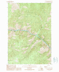
1989 Map of Cottontail Point
USGS Topo · Published 1990About this map
Salmon River (Wild and Scenic River) cuts a dramatic course through this 1980s landscape, serving as the border between several major protected wilderness areas. The map reveals the intricate network of the Nez Perce National Forest, Gospel - Hump Wilderness, and the Frank Church - River of No Return Wilderness. The river is defined by a series of navigational hazards, including Cottontail Rapids, Bull Creek Rapids, and Petes Rock Rapids, highlighting the corridor's significance for early transit and recreation.
Find a feature on this map
32 named features on this map. Tap any name to fly to it.
Don’t see what you’re looking for? This feature index may not catch every label — zoom into the map to look around manually.
Map Details
Editions of this 1989 Cottontail Point Map
This is the sole edition of this map. No revisions or reprints were ever made.
Other maps of this area

1931 · Buffalo Hump
USGS Topo · 1:125,000

1934 · Buffalo Hump
USGS Topo · 1:125,000

1956 · Burgdorf
USGS Topo · 1:62,500

1956 · Warren
USGS Topo · 1:62,500

1956 · Elk City
USGS Topo · 1:250,000

1960 · Elk City
USGS Topo · 1:250,000

1963 · Marble Butte
USGS Topo · 1:24,000

1977 · Silver Spur Ridge
USGS Topo · 1:24,000

1979 · Buffalo Hump
USGS Topo · 1:24,000

1981 · Warren
USGS Topo · 1:100,000