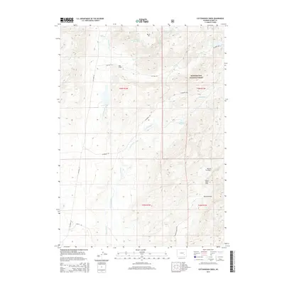
2015 Map of Cottonwood Creek
USGS Topo · Published 2015About this map
The N Laramie River carves through this high-altitude landscape in Albany County, where early 21st-century ranching and water management define the terrain. The map detail highlights an intricate network of highland water systems, including the Joe Ditch and several livestock-focused impoundments like Bar M Number 1 Reservoir and Newell Reservoir. These features, along with names like Hay Draw and Buckland Draw, underscore the historical importance of seasonal water management in this arid grazing country.
Find a feature on this map
26 named features on this map. Tap any name to fly to it.
Don’t see what you’re looking for? This feature index may not catch every label — zoom into the map to look around manually.
Map Details
Editions of this 2015 Cottonwood Creek Map
This is the sole edition of this map. No revisions or reprints were ever made.
Other maps of this area

1954 · Torrington
USGS Topo · 1:250,000

1958 · Torrington
USGS Topo · 1:250,000

1964 · Toltec
USGS Topo · 1:24,000

1964 · Windy Peak
USGS Topo · 1:24,000

1964 · Marshall
USGS Topo · 1:24,000

1968 · Cow Creek Mountain
USGS Topo · 1:24,000

1968 · Cottonwood Creek
USGS Topo · 1:24,000
1968 · Rogers Creek
USGS Topo · 1:24,000
1968 · Garrett
USGS Topo · 1:24,000
1968 · Boot Heel SE
USGS Topo · 1:24,000