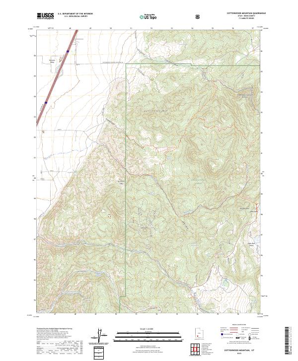
2023 Map of Cottonwood Mountain
USGS Topo · Published 2023About this map
Hurricane Cliffs create a dramatic transition between the high plateaus and the lower desert basins in this portion of Iron County. The landscape is dominated by the sprawling Dixie National Forest, which encompasses a complex network of canyons and high-elevation features like Iron Peak and the Markagunt Plateau. Water sources are critical in this arid environment, evidenced by numerous named springs such as Warm Springs, Mineral Spring, and White Canyon Spring that have supported livestock and wildlife throughout the era.
Find a feature on this map
46 named features on this map. Tap any name to fly to it.
Don’t see what you’re looking for? This feature index may not catch every label — zoom into the map to look around manually.
Map Details
Editions of this 2023 Cottonwood Mountain Map
This is the sole edition of this map. No revisions or reprints were ever made.
Other maps of this area

1885 · Beaver
USGS Topo · 1:250,000

1886 · Kanab
USGS Topo · 1:250,000

1953 · Richfield
USGS Topo · 1:250,000

1953 · Cedar City
USGS Topo · 1:250,000

1958 · Richfield
USGS Topo · 1:250,000

1958 · Cedar City
USGS Topo · 1:250,000

1958 · Minersville
USGS Topo · 1:62,500

1962 · Cedar City
USGS Topo · 1:250,000

1971 · Buckhorn Flat
USGS Topo · 1:24,000

1971 · Paragonah
USGS Topo · 1:24,000