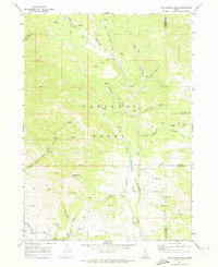
1969 Map of Cottonwood Peak
USGS Topo · Published 1973About this map
The Portneuf Range dominates this late-1960s survey of the high country along the boundaries of Bannock, Caribou, and Franklin counties. Centered on the prominence of Cottonwood Peak, the landscape is defined by a dense network of drainages and canyons that supported early agricultural irrigation, most notably via the Treasureton Canal and Cottonwood Creek. The map documents a transition in land use, showing a topography carved by Mill Canyon and Bullwhacker Canyon alongside numerous named water sources like Time Spring and Dempsey Creek. A primitive transport network consisting of several labeled Jeep Trails provides access to remote landmarks such as Hog Wallow and the livestock-related Lewis Creek. This detailed topographical study illustrates the importance of water management in the Cottonwood Valley during a period of steady ranching and agricultural activity in southeastern Idaho.
Find a feature on this map
28 named features on this map. Tap any name to fly to it.
Don’t see what you’re looking for? This feature index may not catch every label — zoom into the map to look around manually.
Map Details
Editions of this 1969 Cottonwood Peak Map
2 editions found
Other maps of this area

1915 · Preston
USGS Topo · 1:96,000

1918 · Preston
USGS Topo · 1:125,000

1948 · Bancroft
USGS Topo · 1:62,500

1949 · Bancroft
USGS Topo · 1:62,500

1954 · Pocatello
USGS Topo · 1:250,000

1955 · Preston
USGS Topo · 1:250,000

1958 · Pocatello
USGS Topo · 1:250,000

1958 · Preston
USGS Topo · 1:250,000

1962 · Preston
USGS Topo · 1:250,000

1968 · Oxford
USGS Topo · 1:24,000