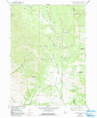
1969 Map of Cottonwood Peak
USGS Topo · Published 1991About this map
The Portneuf Range dominates this late-1960s landscape, centered on the prominent summit of Cottonwood Peak. The terrain is defined by a dense network of drainage systems and high-country canyons, including the complex forks of Left Hand Fork Marsh Creek and Right Hand Fork Marsh Creek. In the southern portion of the quadrangle, the presence of the Treasureton Canal and Swan Lake indicates the managed water resources crucial for the lower elevations. The map reveals a land utilized for both its natural resources and transit, as seen in the numerous 4wd routes traversing canyons like Bullwhacker Canyon and Mill Canyon. Further south, Mine Hollow and Trough Hollow suggest historical land use patterns common to this part of Southeast Idaho, while numerous springs punctuate the high ridges of Shingle Valley and the surrounding peaks.
Find a feature on this map
31 named features on this map. Tap any name to fly to it.
Don’t see what you’re looking for? This feature index may not catch every label — zoom into the map to look around manually.
Map Details
Editions of this 1969 Cottonwood Peak Map
2 editions found
Other maps of this area

1915 · Preston
USGS Topo · 1:96,000

1918 · Preston
USGS Topo · 1:125,000

1948 · Bancroft
USGS Topo · 1:62,500

1949 · Bancroft
USGS Topo · 1:62,500

1954 · Pocatello
USGS Topo · 1:250,000

1955 · Preston
USGS Topo · 1:250,000

1958 · Pocatello
USGS Topo · 1:250,000

1958 · Preston
USGS Topo · 1:250,000

1962 · Preston
USGS Topo · 1:250,000

1968 · Oxford
USGS Topo · 1:24,000