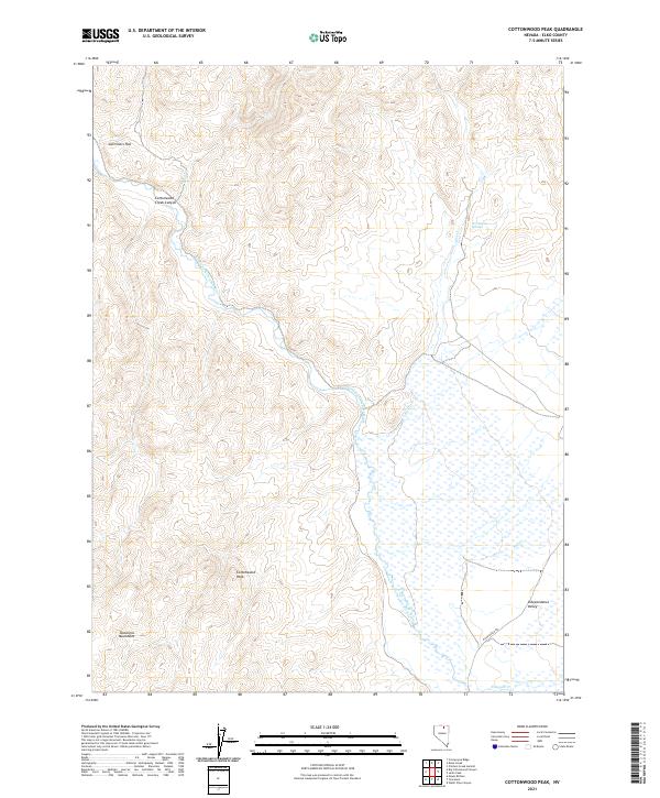
2021 Map of Cottonwood Peak
USGS Topo · Published 2021About this map
The Tuscarora Mountains dominate the western landscape of this high-altitude basin, where the South Fork Owyhee River snakes through the central terrain. This 2021 survey details a rugged intersection of hydrology and topography in Elko County, highlighting the thermal activity at Hot Sulphur Springs along the banks of Hot Cr. The eastern portion of the sheet opens into the broad expanse of Independence Valley, a stark contrast to the steep verticality of Cottonwood Peak and the drainage at Cottonwood Creek Canyon.
Find a feature on this map
18 named features on this map. Tap any name to fly to it.
Don’t see what you’re looking for? This feature index may not catch every label — zoom into the map to look around manually.
Map Details
Editions of this 2021 Cottonwood Peak Map
This is the sole edition of this map. No revisions or reprints were ever made.
Other maps of this area

1955 · McDermitt
USGS Topo · 1:250,000

1956 · Tuscarora
USGS Topo · 1:62,500

1956 · Mt. Blitzen
USGS Topo · 1:62,500

1956 · Bull Run
USGS Topo · 1:62,500

1959 · McDermitt
USGS Topo · 1:250,000

1964 · Wilson Reservoir
USGS Topo · 1:62,500

1982 · Bull Run Mts
USGS Topo · 1:100,000

1982 · Tuscarora
USGS Topo · 1:100,000
1987 · Cottonwood Peak
USGS Topo · 1:24,000
1987 · Big Cottonwood Canyon
USGS Topo · 1:24,000