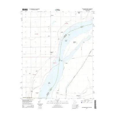
2015 Map of Cottonwood Point
USGS Topo · Published 2015About this map
The Mississippi River creates a dynamic border between Missouri and Tennessee in this 2015 study of the Bootheel region. The landscape is defined by the river's shifting path, featuring prominent deposits like Skullbone Bar, Eagle Bar, and Island Number Twenty. On the Missouri side, the grid-like agricultural drainage around Cottonwood Point and Tyler is punctuated by the Midway Crevasse, reflecting the area's history of flooding and levee breaches. The Tennessee shoreline near Ayers and Heloise remains dominated by the riparian environment of Everett Lake and Big Slough. Genealogists will find the locations of Hickman Cemetery and Taylor Cemetery preserved among the scattered settlements and farm roads like Chic Rd and The Great River Rd.
Find a feature on this map
49 named features on this map. Tap any name to fly to it.
Don’t see what you’re looking for? This feature index may not catch every label — zoom into the map to look around manually.
Map Details
Editions of this 2015 Cottonwood Point Map
This is the sole edition of this map. No revisions or reprints were ever made.
Other maps of this area

1939 · Hales Point
USGS Topo · 1:62,500

1939 · Caruthersville
USGS Topo · 1:62,500

1939 · Blytheville
USGS Topo · 1:62,500

1940 · Hayti
USGS Topo · 1:62,500

1951 · Caruthersville
USGS Topo · 1:62,500

1952 · Hales Point
USGS Topo · 1:62,500

1955 · Hayti
USGS Topo · 1:62,500

1955 · Blytheville
USGS Topo · 1:62,500

1956 · Dyersburg
USGS Topo · 1:250,000

1956 · Blytheville
USGS Topo · 1:250,000