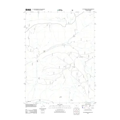
2012 Map of Cottonwood Rim
USGS Topo · Published 2012About this map
Battle Creek flows through the center of this high-altitude landscape along the Wyoming-Colorado border, where the high-plains terrain transitions between named peaks and significant water management features. The Belvidere Ditch cuts across the northern portion of the map, illustrating the importance of water diversion in the West. Prominent landmarks such as Sheep Mountain and Mule Mountain overlook a series of deep drainages, including Upper Big Gulch and Road Gulch. Near the southern edge, the Little Snake River provides a primary drainage point for the surrounding cattle country. This era of the landscape is defined by its rural road network, notably Sage Creek Rd and Co Rd 129, which connect remote outposts like the Battle Creek Campground to the wider region. Collectors and local historians will find the naming of specific features like Stemp Spring and Cottonwood Park useful for identifying historic grazing and water rights in this borderland.
Find a feature on this map
22 named features on this map. Tap any name to fly to it.
Don’t see what you’re looking for? This feature index may not catch every label — zoom into the map to look around manually.
Map Details
Editions of this 2012 Cottonwood Rim Map
This is the sole edition of this map. No revisions or reprints were ever made.
Other maps of this area

1932 · Savery
USGS Topo · 1:96,000

1940 · Savery
USGS Topo · 1:125,000

1954 · Rawlins
USGS Topo · 1:250,000

1954 · Craig
USGS Topo · 1:250,000

1957 · Craig
USGS Topo · 1:250,000

1958 · Rawlins
USGS Topo · 1:250,000

1958 · Craig
USGS Topo · 1:250,000

1960 · Craig
USGS Topo · 1:250,000

1961 · Grieve Reservoir
USGS Topo · 1:24,000

1961 · Bridger Peak
USGS Topo · 1:24,000