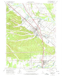
1965 Map of Cottonwood
USGS Topo · Published 1975About this map
Anderson and Cottonwood serve as the primary hubs in this mid-1960s study of the northern Sacramento Valley, where the Southern Pacific railroad and the burgeoning Interstate 5 corridor parallel the Sacramento River. The landscape transitions from the flat Stillwater Plains in the northeast to the undulating gulches of the west, such as Telephone Gulch and Spanish Canyon. Local institutions are well-documented, including the Shasta District Fairgrounds and the Oddfellows Cem in Anderson.
Find a feature on this map
39 named features on this map. Tap any name to fly to it.
Don’t see what you’re looking for? This feature index may not catch every label — zoom into the map to look around manually.
Map Details
Editions of this 1965 Cottonwood Map
3 editions found
Other maps of this area

1890 · Red Bluff
USGS Topo · 1:250,000

1894 · Red Bluff
USGS Topo · 1:250,000

1901 · Redding
USGS Topo · 1:125,000

1932 · Olinda
USGS Topo · 1:31,680

1935 · Olinda
USGS Topo · 1:31,680

1944 · Redding
USGS Topo · 1:62,500

1944 · Tuscan Buttes
USGS Topo · 1:62,500

1946 · Redding
USGS Topo · 1:62,500

1947 · Tuscan Buttes
USGS Topo · 1:62,500

1947 · Anderson
USGS Topo · 1:62,500