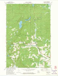
1971 Map of Couderay
USGS Topo · Published 1973About this map
The Couderay River carves through this Sawyer County landscape, serving as a focal point for the village of Couderay and the neighboring settlement of Lemington. This early 1970s survey illustrates a region defined by its complex hydrology and conservation efforts, notably the Eddy Creek State Wildlife Management Area and the Beverly Lake State Wildlife Management Area. The northern portion of the map is dominated by the Lac Courte Oreilles Indian Reservation Boundary, enclosing numerous water bodies such as Devils Lake and Ashegon Lake.
Find a feature on this map
30 named features on this map. Tap any name to fly to it.
Don’t see what you’re looking for? This feature index may not catch every label — zoom into the map to look around manually.
Map Details
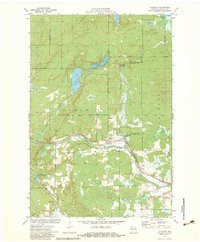
Editions of this 1971 Couderay Map
2 editions found
Other maps of this area

1944 · Exeland
USGS Topo · 1:48,000

1944 · Couderay
USGS Topo · 1:48,000

1944 · Radisson
USGS Topo · 1:48,000

1945 · Meteor
USGS Topo · 1:48,000

1947 · Exeland
USGS Topo · 1:48,000

1948 · Couderay
USGS Topo · 1:48,000

1949 · Radisson
USGS Topo · 1:48,000

1949 · Meteor
USGS Topo · 1:48,000

1953 · Rice Lake
USGS Topo · 1:250,000

1959 · Rice Lake
USGS Topo · 1:250,000