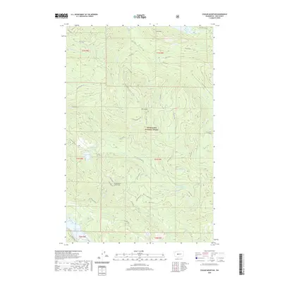
2020 Map of Cougar Mountain
USGS Topo · Published 2020About this map
Snoqualmie National Forest and the Green River Watershed dominate this Cascades landscape, where water management and timber access define the geography. The northern edge is anchored by Chester Morse Lake, while the southern reaches contain the Howard A Hanson Reservoir. The terrain is characterized by high peaks like Mt Lindsay and Little Mtn, which are surrounded by a dense network of forest development roads such as Nat For Dev Rd 110 and NFD 5100 Rd. These routes track the drainage basins of the Rex River and the N Fork Green River. Small alpine features, including Eagle Lake and the Tsuga Lakes, are tucked between the ridges, illustrating the transition between protected watershed areas and managed national forest lands in this high-elevation corner of King County.
Find a feature on this map
50 named features on this map. Tap any name to fly to it.
Don’t see what you’re looking for? This feature index may not catch every label — zoom into the map to look around manually.
Map Details
Editions of this 2020 Cougar Mountain Map
This is the sole edition of this map. No revisions or reprints were ever made.
Other maps of this area

1913 · Cedar Lake
USGS Topo · 1:125,000

1953 · North Bend
USGS Topo · 1:24,000

1953 · Eagle Gorge
USGS Topo · 1:24,000

1956 · Greenwater
USGS Topo · 1:62,500

1956 · Enumclaw
USGS Topo · 1:62,500

1957 · Wenatchee
USGS Topo · 1:250,000

1960 · Bandera
USGS Topo · 1:62,500

1975 · Snoqualmie Pass
USGS Topo · 1:100,000
1986 · Nagrom
USGS Topo · 1:24,000
1986 · Cyclone Creek
USGS Topo · 1:24,000